
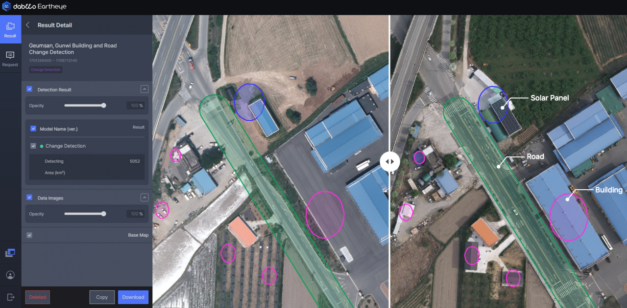
In June, Dabeeo, an AI technology company specializing in geospatial information, successfully completed the '1:1000 Topographic Map Enhancement Pilot Project' initiated by the National Geographic Information Institute of the Ministry of Land, Infrastructure, and Transport. Over the 180-day project period, Dabeeo utilized AI change detection technology to identify alterations in buildings, roads, and other features across a 54-square-kilometer area spanning from Geumsan-gun, South Chungcheong Province, to Gunwi-gun in Daegu. This project marked a significant advancement for Dabeeo, as it not only built on its existing urban change detection projects but also incorporated a new process for converting aerial images into true orthophotos, thereby enhancing the accuracy of the analysis data through an advanced algorithm. The introduction of true orthophoto conversion played a pivotal role in improving the precision of Dabeeo's change detection model, achieving a 90 percent precision rate in the F1-Score metric. The project garnered acclaim for its ability to accurately analyze changes such as the emergence, disappearance, and updates of various structures within the observed area, including buildings, roads, crosswalks, and solar panels on rooftops. Looking ahead, Dabeeo aims to enhance its accuracy even further by categorizing undetected cases from the current project and integrating them into future learning models. Leveraging its expertise from previous projects, including the Daejeon change detection project, Dabeeo is set to expand its initiatives, having recently secured an agreement with Bucheon City in Gyeonggi Province for a new change detection project, signaling its commitment to continuous research and development in AI change detection technology.